 Facebook
 LINE
LINE
According to the “Forestry Act” and “Survey method for trees besides forests and standard for determining protected trees”, trees within a jurisdiction should be surveyed at least once every 5 years by the local authority. Currently, the Construction Bureau has completed stage one of the survey (29,000 roadside trees) and entered the information into the management system database. In the future, surveys will be conducted in separate years and stages, and database will also be created accordingly.
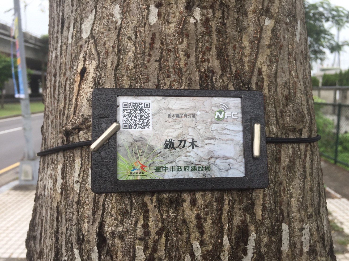
In order to perform smart roadside tree management, Construction Bureau launched the “Taichung City Roadside Tree Electronic ID” system in 2016, where people can scan the QR Code attached to the tree with their smart phone to obtain information. The tree ID also features several functions; for example, the tree plaque is made from water/temperature resistant PVC material and laminated in anti-UV film, and it is suspended on the tree using elastic rope that will not harm the tree trunk.
In particular, the upper right hand corner of the electronic ID contains a NFC (Near Field Communication) that cannot be cloned. This acts as the roadside tree’s health insurance card, so that when contractors are applying pest/disease control measures or trimming the trees, NFC allows far quicker and more precise positioning than cell phones. As a result, tree maintenance crew can reach the reported location more quickly, and it also significantly improves the efficiency of rescuing damaged roadside trees. After tree maintenance is completed, the data can be sent directly to the roadside tree maintenance and management information platform in order to report the roadside tree’s precise coordinates.
In the future, the public can search for information disclosed by the government using the roadside tree coordinate data, such as nearby tree-viewing scenic attractions, parks, iBike or parking lots. The diverse functions will be integrated with “Taichung Guide” app toward the second half of this year.
According to Construction Bureau Director-general Yu-lin Huang, the promotion of tree ID is coherent with the global trend; in addition to Taichung, other municipalities are also studying the benefits of the system. The City Government will carry out the second stage of the roadside tree survey in the second half of this year, where the maintenance management information platform, app and electronic ID webpage will be augmented. It is expected that citywide roadside tree survey will be completed within 4 years, where Taichung City’s roadside tree management efficiency will be reinforced through data integration and analysis, in turn building a more comprehensive roadside tree management mechanism.